Tech and Innovation
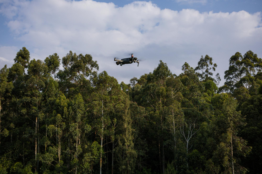
In the past, drone was identical with cool landscape photos or cinematic videos that we often saw on social media. Now, its function is much greater. Drone has developed into an important tool capable of supporting nature and environmental conservation efforts. With the ability to reach areas that are difficult for humans to access, this technology can provide visual data that is fast, accurate, and cost-effective. According to KLHK, Indonesia has 125.76 million hectares of tropical forest that must be preserved for the sustainability of the global ecosystem.
At Jejakin, drone is used to map conservation areas and monitor land cover changes, so that ecosystem preservation efforts can be carried out more quickly, accurately, and efficiently.
Drone has various functions in conservation activities, including the following:
Although promising, the use of drone for conservation is not free from a number of factors that need to be considered. From a technical side, battery limitations make drone only able to fly for 20–60 minutes, and weather factors such as rain or strong winds can limit operations. Meanwhile, from a regulatory side, flight rules and permits from relevant authorities become an important element so that the use of drone runs safely, legally, and is not misused.
In the future, drone technology is predicted to become increasingly sophisticated and integrated with various other systems. Some trends that are starting to appear are as follows:
Drone has proven itself to be a relevant technology in supporting forest and environmental conservation. From deforestation monitoring, vegetation inventory, to wildlife protection, all can now be done more efficiently.
However, for the benefits of drone to be truly maximized, adaptive regulatory support, cross-sector collaboration, and the involvement of local communities are needed. Thus, this technology is not only a tool, but also part of a grand strategy to keep our earth sustainable.
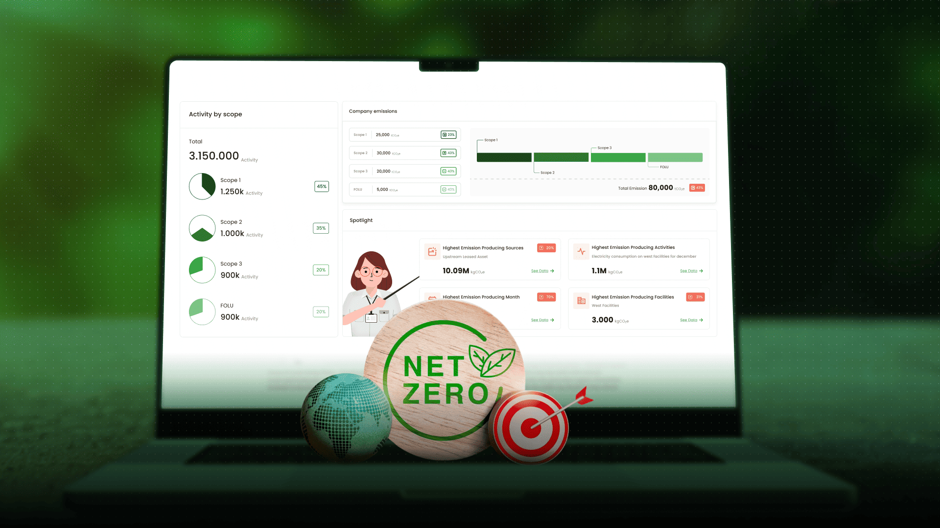
As a next step, data management from drone will be much more effective if combined with a digital-based monitoring platform. This is where CarbonAtlas by Jejakin comes in, offering mapping, monitoring, and data-based verification solutions to support sustainability.
With CarbonAtlas, governments, businesses, and communities can make more accurate data-based decisions such as starting from measuring emissions, monitoring carbon sequestration, to reporting the results transparently. Let us use this technology not only to understand the earth, but also to protect it together.
If you want to know how CarbonAtlas can help your organization or business achieve sustainability targets, contact us to discuss and find the best solution with you.


Jejakin’s green programs combine high-tech monitoring, biodiversity restoration, and community-led initiatives to deliver powerful, sustainable change across ecosystems.