Tech and Innovation
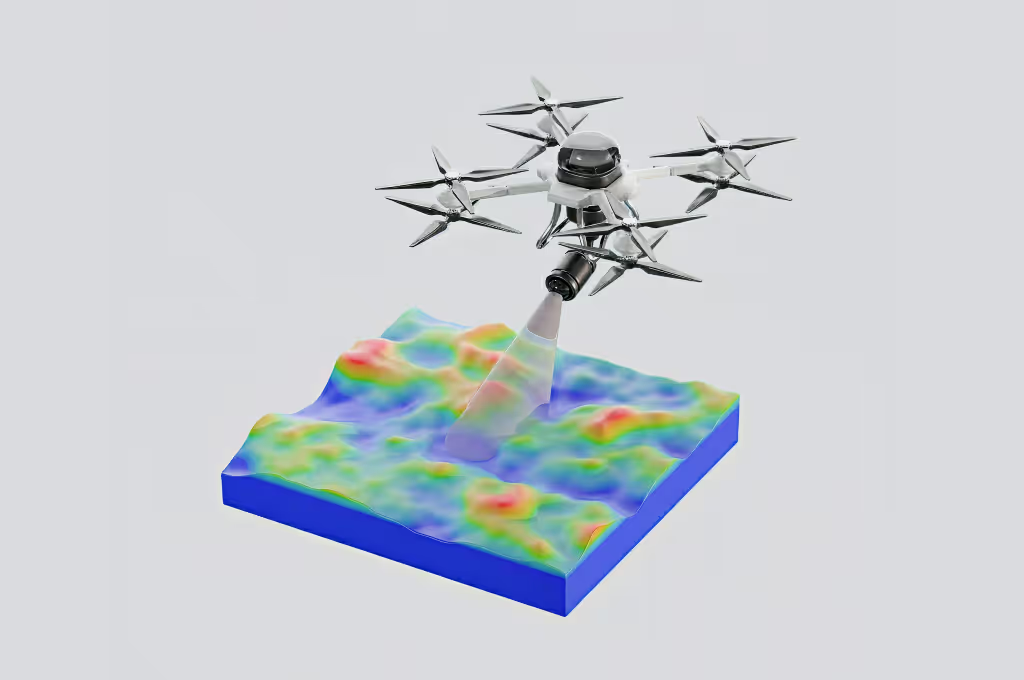
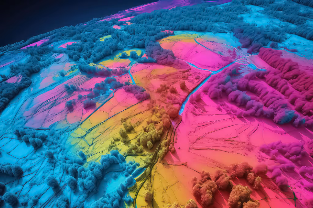
LiDAR (Light Detection and Ranging) is a mapping technology that uses lasers to measure distances with high precision. Its working principle is simple but very effective: a LiDAR device emits laser beams toward an object and measures the time it takes for the reflected signal to return to the sensor. From this process, the system can generate a three-dimensional (3D) model of the Earth’s surface, including forest topography, vegetation, and soil structures.
In the last decade, LiDAR has become one of the most important technologies in the field of environmental conservation. Its advantage lies in its ability to produce detailed data that cannot be obtained through satellite images or conventional drones alone. LiDAR can even “penetrate” forest canopies to capture the vegetation structure beneath them.
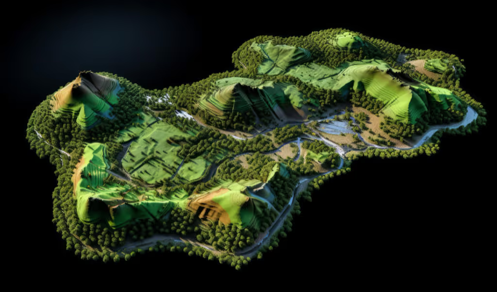
LiDAR is a game-changer in conservation because it can “peek” beneath forest canopies. While satellites or regular drones only capture the upper layers, LiDAR provides a complete picture from the top to the lower layers of vegetation. With this level of detail, researchers can more easily monitor forest conditions, detect changes, and develop more targeted conservation strategies.
The applications of LiDAR in forest conservation are wide-ranging. Some examples include:
There are several reasons why LiDAR is superior to other mapping technologies for conservation:
As one of the countries with the largest tropical forests in the world, Indonesia has great potential to utilize LiDAR. Mapping with LiDAR can help:
With Indonesia’s commitment to reducing carbon emissions, LiDAR can become an important instrument to support data-driven policies.
LiDAR is not just a mapping technology but an essential tool in forest and environmental conservation. Its ability to provide detailed forest structures, calculate carbon stocks, and detect ecosystem changes makes it a powerful weapon against deforestation and environmental degradation.
Although there are still challenges such as costs and technical expertise, the long-term benefits far outweigh them. With proper application, LiDAR can help us preserve the lungs of the Earth.
Curious about how LiDAR can support your project? Reach out to Jejakin for a consultation.


Jejakin’s green programs combine high-tech monitoring, biodiversity restoration, and community-led initiatives to deliver powerful, sustainable change across ecosystems.